

Baku, August 31, AZERTAC
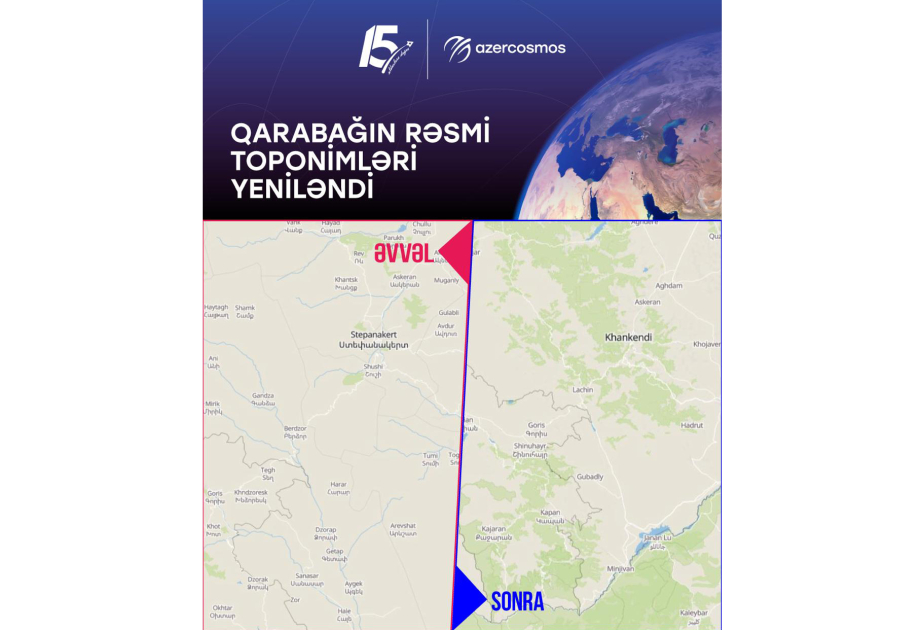
“Following an initiative by the Azercosmos team, the map covering Azerbaijan on the EOSDA platform has been successfully updated,” the Space Agency of the Republic of Azerbaijan (“Azercosmos”) said on X.
“During our review of the platform’s base map, we identified outdated settlement names, particularly across the Garabagh region. To support the update, our team shared relevant information published through Azerbaijan’s official Open Data Portal, providing an authoritative reference for the country’s official geographical names.
Following a detailed review by the EOS product team, the relevant map data was updated. As a result, the official names of settlements including Khankendi, Khojavand, Aghdara, Sugovushan and others are now accurately reflected on the platform.
This update demonstrates how cooperation, authoritative open data and attention to geographical accuracy can improve the quality of information available to users of international digital platforms.
We sincerely thank the EOSDA team, for their constructive cooperation, careful consideration of the official data provided and successful implementation of the update,” the agency added.
Source: azertag.az







 scorpion.az